
Tracing a Meridian Township Street
A street-by-street search works best as an evidence trail, not as a roster. Begin with the address as written, verify its mailing result with USPS when needed, and use the township property record to obtain the parcel number and legal description. Those two identifiers hold the trail together when a parcel has been split, a subdivision was added, or an old directory used a different number. The address alone is not enough to decide title or current residence.
- Enter one exact address in Meridian Township BSA Online. Retain the returned parcel number, situs address, displayed owner or taxpayer role, legal description, tax year, source date, and record URL.
- Use the county map or, when available, the GIS viewer to confirm the legal municipality and place the parcel beside the correct road. Do not make up parcel numbers in sequence along a street.
- For a recorded land question, search the party names and legal description through the Ingham Register of Deeds. Read the deed image before treating an index row as a transfer finding.
- Move backward through the chain: current grantee, prior grantor, then that grantor as a prior grantee. Compare the legal description at every step, especially across plats and condominium records.
- For an earlier household clue, check CADL and MSU directory material under Meridian, Okemos, Haslett, East Lansing, Lansing, and any old post-office wording. Treat the result as a dated listing, not a current identity claim.
Each source answers a narrower question. BSA supplies the assessment-facing parcel record. The recorder supplies recorded instruments. A directory supplies a historical publication entry. Keeping those roles separate prevents a street directory search from claiming more than the records support.
Meridian Township Address Search Fields
Meridian's BSA property portal is the main entry point for a present-day street record. Its basic search uses three tabs, and the parcel number becomes the steadier citation once the address search returns a match. The portal can expose current or historical tax and assessment services, sales, special assessments, sketches, and building-related records where Meridian publishes them. Its displayed fields and access options vary by service, so preserve the actual result rather than assuming every address has the same details.
| Meridian BSA field | Use on a street search | Confirmed options |
|---|---|---|
| Address | Find the property record from the street number and street name | Basic search tab |
| Name | Find a displayed taxpayer or owner-name entry after the address is known | Basic search tab |
| Parcel Number | Return to the stable parcel record and cite it with the source date | Basic search tab |
| Sale date | Narrow a property-sales search to a period | Advanced sales filter |
| Sale price and property class | Refine a sales query by price and Agricultural, Commercial, Residential, Industrial, Timber Cutover, or Developmental class | Advanced sales filters |
The BSA advanced property-sales search shows the available sale-date, price, and class filters.
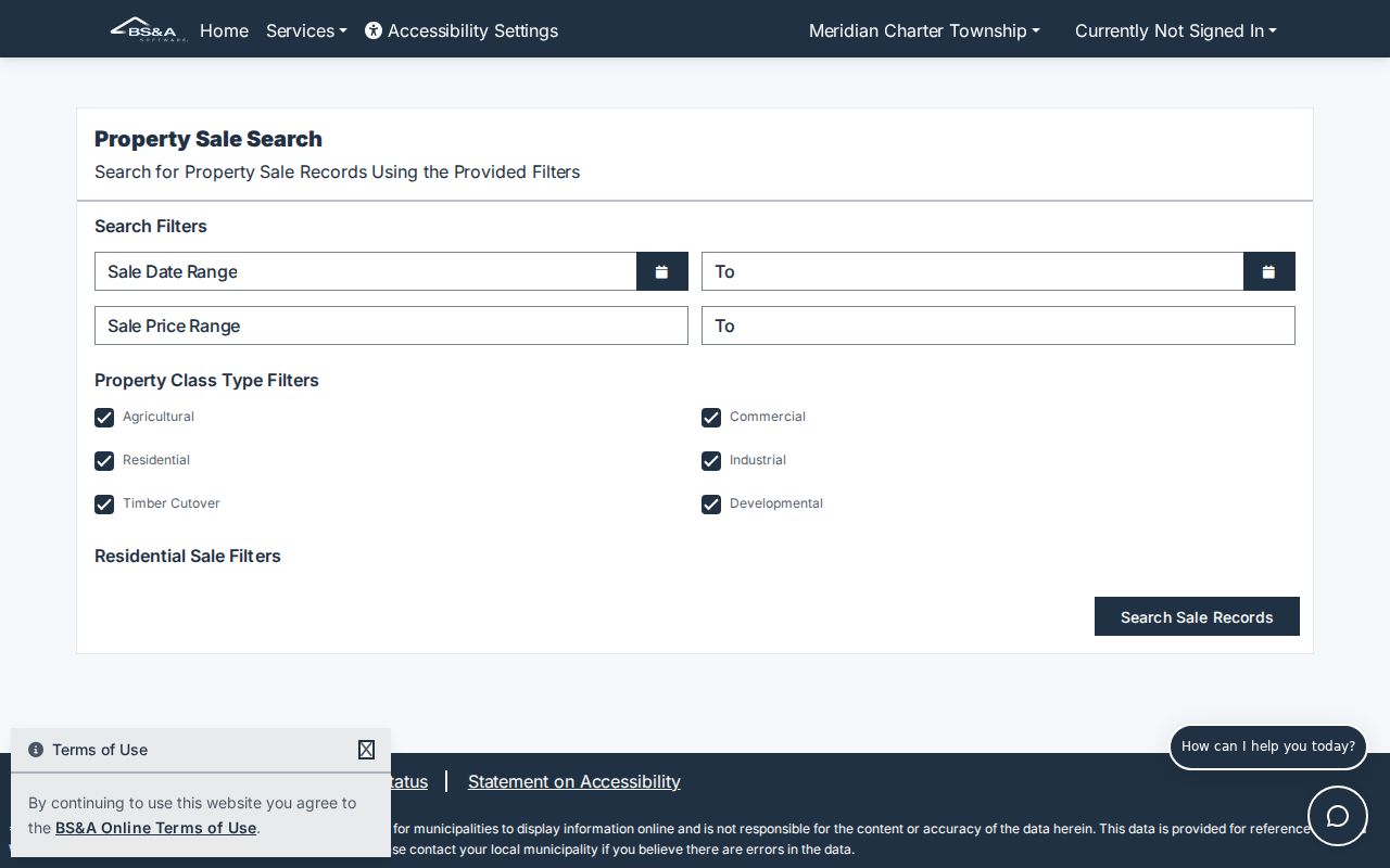
Those filters help compare published sales records, but they do not turn BSA into a current street directory of occupants. The township, rather than the software vendor, is the correction authority for a property-record error.
Note: The basic BSA interface did not expose a ZIP field, so verify a postal ZIP at the individual address level rather than grouping parcels by assumption.
Meridian Township Street Record Coverage
Several record systems can be keyed to the same street address, yet their limits differ. The table below separates a tax or parcel connection from a recorded instrument, a map relationship, a planning event, and a historic listing. It also keeps the lawful voter routes out of the category of an open street roster.
| Street-keyed source | What it can show | Access and limit |
|---|---|---|
| BSA address search | Parcel, taxpayer display, value, tax, sales, and possible permit-related material | Online by address, name, or parcel; owner is not automatically an occupant |
| Ingham GIS | Mapped parcel relationship, legal municipality, and adjacent polygons | Public viewer route; live controls and layer names were not captured |
| Register of Deeds | Recorded transfers and encumbrances tied to parties and legal descriptions | Index, image, vault, and mail paths; coverage limits apply |
| Meridian Planning and BSA | Addressed applications, permits, or code-action clues | Availability varies; an applicant or permit is not household proof |
| CADL and MSU directories | Historic address-to-household or business clue | Year and publisher scope vary; use publication date and page |
| USPS lookup | Mailing city and ZIP for one address | Postal result, not a legal-boundary decision |
Use the parcel number to connect the assessment record to the map and the legal description to connect it to recorded instruments. A road can cross a ZIP, a subdivision boundary, or a township line. That is why a street directory search should proceed address by address instead of relying on a guessed string of parcels.
Meridian Township Street Record Terms
Some of the most useful labels look alike but point to different facts. Read them before comparing a BSA result, a plat, or a historic criss-cross listing. A careful street directory note records the source role and date beside each field.
- Parcel
- A county or township property identifier that links an assessment record to a mapped piece of land. It is stronger than an address for modern cross-reference, but it can change when land is split or combined.
- Situs address
- The physical property location used by assessment and planning searches. It is distinct from the mailing address used for correspondence.
- Plat
- A recorded subdivision plan that can explain lot, block, street, or unit relationships. It helps bridge a modern street number to a legal description.
- Criss-cross directory
- The street-order part of a historic directory. It may offer an address-to-listed-household or business clue for its publication year.
A mailing address can belong to an out-of-area owner, a trust, a corporation, or an agent. A situs address identifies the property itself. Neither label, standing alone, proves who lives there.
Meridian Township Street Map Limits
The county's Meridian roads map supplies useful broad context, including the shaded East Lansing city limits and township hall location.
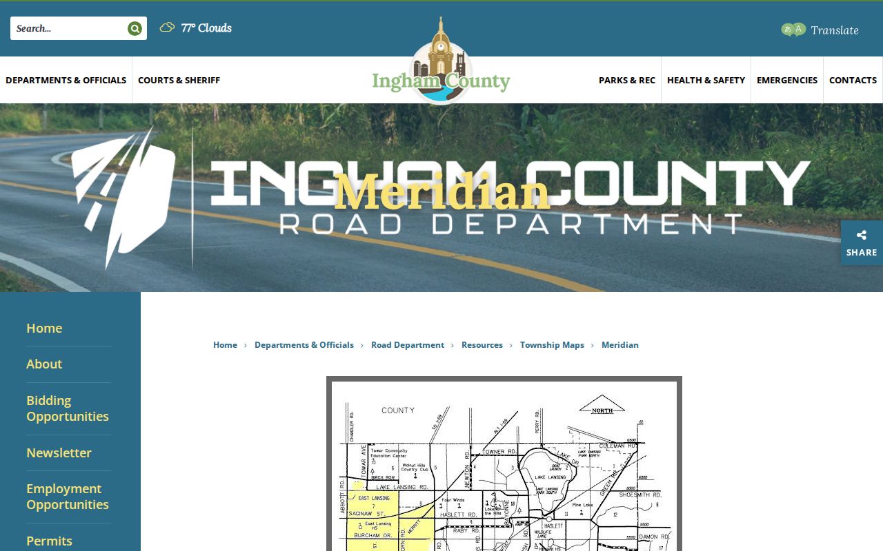
Use the map to orient a road, then confirm a selected parcel with BSA and the Register of Deeds. The MSU-hosted Equalization GIS viewer was blocked during unattended review. Its exact layer names, parcel-click panel, basemap controls, export functions, and any measuring tools were not captured, so none are asserted here. A map outline is a location clue, not proof of title.
Meridian also has real mailing patterns under Okemos, Haslett, and East Lansing labels. USPS verifies delivery for an address; a parcel viewer verifies legal geography. Do not silently replace one label with the other.
Meridian Township Street Planning Records
Address-specific planning material can help date a land-use or construction event. A focused request can name the street address, parcel number if known, a date range, and a record category such as an approval, permit, board minutes, or a public code action. Michigan FOIA requests must be written and sufficiently describe the record. Meridian reports a five-working-day response period, with a possible ten-day extension, and its online JustFOIA controls should be checked when a request is prepared.
The Meridian planning applications and permits page is the public entry point for an Address Request Application and related forms.
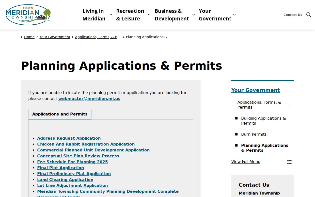
Planning records can show a dated action, application, or public decision connected to a location. They should not be used to assert that every named party was part of the household. The accessible material did not establish a complete public crosswalk for renumbered streets, retired addresses, or E911 assignments.
Note: Ask Meridian Planning or Ingham GIS for a historical address crosswalk before treating an old street number as a confirmed modern parcel match.
Meridian Township Deed Records
Recorded land instruments are held by the Ingham County Register of Deeds in Mason. Direct Search provides a free index beginning in 1956, except for the last seven days. Tapestry supplies records from 1956 and images generally from 1960, while Laredo is a subscription route with broadly similar coverage. The online index is a lead, not the final finding. For a decisive title question, read the image and compare its legal description against the parcel record.
The Ingham County Register of Deeds fee schedule gives the current published copy framework.
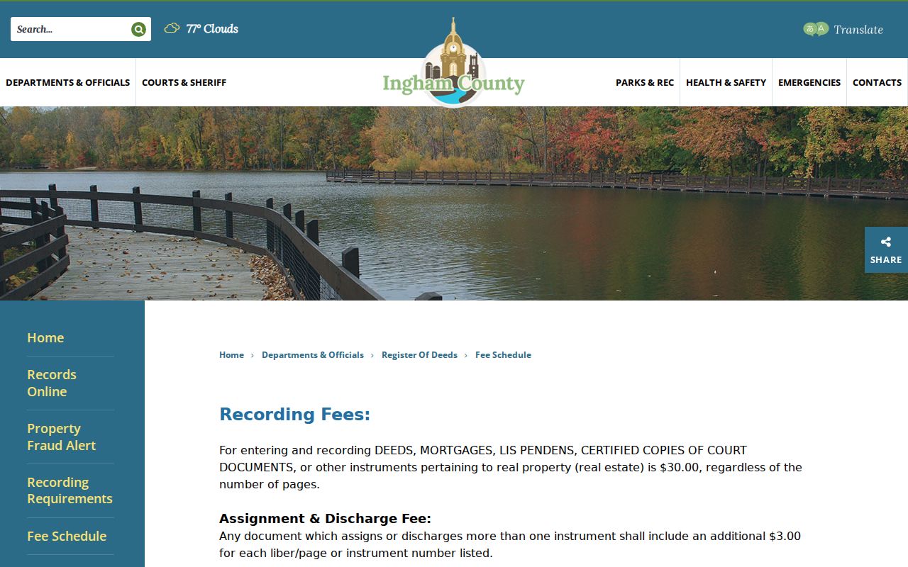
The schedule lists recorded copies at $1 per page and certified recorded copies at $5 per document plus $1 per page. It also lists Tapestry at $8.95 per search plus $1 per printed image page. Confirm charges at checkout or with the office because fees can change.
Use the Mason vault and copy route for older material. The county identifies index-conversion discrepancies in 1956-1981 data and describes 1982-forward indexing as proven accurate. Copies before 1960 require the Register of Deeds office, and 1956-1981 questions may need vault checking rather than a longer online search.
Meridian Township Street History Clues
Historic listing research is the fallback when a modern parcel record cannot explain an earlier address. CADL holds Lansing directories from 1867 forward in its Local History Room, with branch access to full-text Lansing coverage through 1960 in Ancestry Library Edition. MSU holds Polk directories from 1896-1941 in Special Collections and later editions in the stacks. Its guide also lists Sanborn maps from 1867-1970, though Meridian coverage may be partial. Publisher scope matters because suburban areas were not included in every year.
Insider tip. Search the historic community name and the old address number before deciding that a Meridian entry is absent. Haslett, Okemos, East Lansing, Lansing, and the former Village of Hamilton can all appear in local historical sources. CADL warns that early Lansing numbering can differ from current numbering. The Meridian Township city directories collection route is the better place to read those printed sources year by year.
A directory entry can document a surname, relation, address, or other publication detail on a specific date. It does not establish current title, present residence, or a continuous household history. Preserve the edition, page or image, geographic heading, original abbreviation, and any uncertain address crosswalk.
Meridian Township Street Voter Limits
The Michigan Voter Information Center is a personal-status lookup for registration, polling place, sample ballot, and absentee tracking. It is not a public street directory. The live controls did not render in the unattended review, so exact current entry fields and non-match wording require normal-browser confirmation before anyone describes a form workflow.
A Qualified Voter File request is a formal request, not a click-to-download block list. The state form requires requester identity, organization and contact information, a signature and date, a selected geographic or election-history scope, and pickup, FTP, or mail delivery. Its accessible instructions contain differing CSV, encrypted flash-drive, and fixed-length ASCII language and do not show a clear fee table. Verify the current revision before ordering. For a historical address question, dated directories, census schedules, assessment rolls, and archive series are a more appropriate fallback than treating voter data as an unrestricted street list.
Meridian Township Street Privacy
A useful street directory keeps the result as narrow as the research purpose. Do not publish full residential addresses for living people when a parcel-level or street-level reference will do. Protected persons, minors, Address Confidentiality Program participants, sealed material, and restricted voter or motor-vehicle fields require special care. A no-match does not prove disappearance, fraud, or ineligibility.
Privacy boundary. Use Meridian Township street records only for lawful, personal research. Do not use a record trail to stalk, harass, intimidate, or harm anyone.
Separate direct records, index leads, map relationships, historical clues, and inferences in any research notes. This simple distinction makes correction possible when a custodian updates a source or an old address match remains unresolved.